ZIP Code 5: 79944 - EL PASO, TX
ZIP Code 79944 is the postal code in EL PASO, TX. Besides the basic information, it also lists the full ZIP code and the address of ZIP code 79944. Whatsmore, there is more information related to ZIP Code 79944. For example, nearby ZIP code around ZIP Code 79944, etc.
ZIP 79944 Basic Information

The basic information of ZIP Code 79944 is as follows, including: country, county, city, FIPS and etc.
| State | County | City | ZIP Code 5 |
|---|---|---|---|
| TX - Texas | El Paso County | EL PASO | 79944 |
What is the plus 4 zip code for 79944 ZIP Code? Below is the detail.
79944 ZIP+4 Code List

What are the 4 digit zip extensions of ZIP Code 79944? ZIP code 79944 has many plus 4 codes, and each plus 4 code corresponds to one or more addresses. Below we list all the ZIP+4 codes and their addresses in the ZIP Code 79944. You can find a 9-digit ZIP Code by a full address.
| ZIP Code 5 Plus 4 | Address |
|---|---|
| 79944-1008 | 219 MILLS AVE UNIT 651 (From 651 To 675 Both of Odd and Even), EL PASO, TX |
| 79944-1009 | 219 MILLS AVE UNIT 676 (From 676 To 687 Both of Odd and Even), EL PASO, TX |
| 79944-1010 | 219 MILLS AVE UNIT 691 (From 691 To 700 Both of Odd and Even), EL PASO, TX |
| 79944-1011 | 219 MILLS AVE UNIT 701 (From 701 To 722 Both of Odd and Even), EL PASO, TX |
| 79944-1012 | 219 MILLS AVE UNIT 731 (From 731 To 740 Both of Odd and Even), EL PASO, TX |
- ‹‹
- Page 2
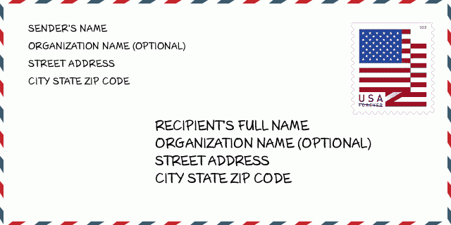
How to write a U.S. envelope?

-
First, you need to fill in the recipient's mailing information in the center of the envelope. The first line is the recipient's name, the second line is the street address with a detailed house number, and the last line is the city, state abbr, and ZIP Code.
Second, write the sender's information on the left top corner of the envelope. If your mail cannot be delivered, it will return to the sender's address.
Finally, don't forget to stick the stamp on the right top corner. Otherwise, the letter will not go into the delivery process.
Here is the envelope example below.
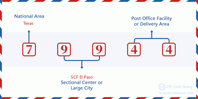
What does each digit of ZIP Code 79944 stand for?
-
The first digit designates a national area, which ranges from zero for the Northeast to nine for the far West.
The 2-3 digits represent a sectional center facility in that region.
The last two digits designate small post offices or postal zones.
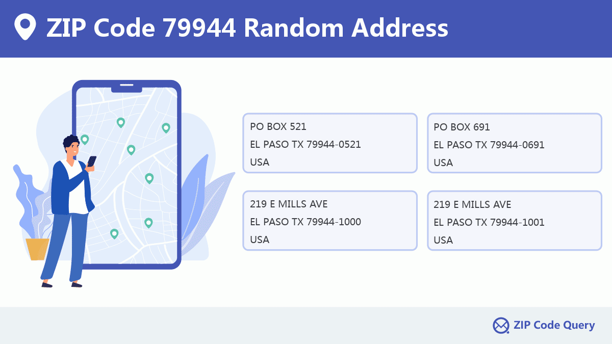
Random Address in ZIP 79944

ZIP Code 79944 has 15 real random addresses, you can clicking the picture below to get random addresses in ZIP Code 79944.
ZIP 79944 Online Map

This is online map of the address EL PASO, El Paso County, Texas. You may use button to move and zoom in / out. The map information is for reference only.
ZIP 79944 NearBy ZIP Code
The Nearby ZIP Codes are 79901, 79929, 79968, 79902, and 79903, you can find ZIP codes in a 25km radius around ZIP Code 79944 and the approximate distance between the two ZIP codes.
The data has a slight deviation for your reference only.
| ZIP Code | Distance (Kilo Meters) |
|---|---|
| 79901 | 0.465 |
| 79929 | 0.577 |
| 79968 | 2.345 |
| 79902 | 3.159 |
| 79903 | 4.99 |
| 79905 | 5.409 |
| 79910 | 5.906 |
| 79930 | 6.308 |
| 79920 | 7.354 |
| 79922 | 8.231 |
| 88063 | 9.421 |
| 79915 | 9.895 |
| 79904 | 10.389 |
| 79925 | 10.976 |
| 79906 | 11.309 |
| 79912 | 11.548 |
| 79918 | 12.425 |
| 79935 | 14.679 |
| 79907 | 16.054 |
| 79924 | 16.456 |
| 79932 | 17.552 |
| 88008 | 17.584 |
| 79936 | 18.069 |
| 79934 | 21.097 |
| 79835 | 21.397 |
| 79927 | 23.416 |

Comment


Add new comment