ZIP Code 5: 79938 - EL PASO, TX
ZIP Code 79938 is the postal code in EL PASO, TX. Besides the basic information, it also lists the full ZIP code and the address of ZIP code 79938. Whatsmore, there is more information related to ZIP Code 79938. For example, nearby ZIP code around ZIP Code 79938, etc.
ZIP 79938 Basic Information

The basic information of ZIP Code 79938 is as follows, including: country, county, city, FIPS and etc.
| State | County | City | ZIP Code 5 |
|---|---|---|---|
| TX - Texas | El Paso County | EL PASO | 79938 |
| TX - Texas | Hudspeth County | EL PASO | 79938 |
📌It means zip code 79938 is across counties/cities.
What is the plus 4 zip code for 79938 ZIP Code? Below is the detail.
79938 ZIP+4 Code List

What are the 4 digit zip extensions of ZIP Code 79938? ZIP code 79938 has many plus 4 codes, and each plus 4 code corresponds to one or more addresses. Below we list all the ZIP+4 codes and their addresses in the ZIP Code 79938. You can find a 9-digit ZIP Code by a full address.
| ZIP Code 5 Plus 4 | Address |
|---|---|
| 79938-0300 | 15200 (From 15200 To 15299) NEWELL HEIGHTS LN, EL PASO, TX |
| 79938-0302 | 15100 (From 15100 To 15199) PERRY AVE, EL PASO, TX |
| 79938-0303 | 15200 (From 15200 To 15299) PERRY AVE, EL PASO, TX |
| 79938-0304 | 15400 (From 15400 To 15499) DEBRA KAYE AVE, EL PASO, TX |
| 79938-0305 | 15300 (From 15300 To 15399) NEWELL HEIGHTS LN, EL PASO, TX |
| 79938-0306 | 17500 (From 17500 To 17599) BETTINA AVE, EL PASO, TX |
| 79938-0308 | 15500 (From 15500 To 15599) DEBRA KAYE AVE, EL PASO, TX |
| 79938-0309 | 15496 DEBRA KAYE AVE UNIT B, EL PASO, TX |
| 79938-0400 | 3800 (From 3800 To 3899) CENTURY DR, EL PASO, TX |
| 79938-0402 | 3900 (From 3900 To 3999) CENTURY DR, EL PASO, TX |
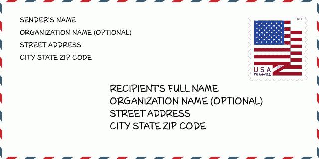
How to write a U.S. envelope?

-
First, you need to fill in the recipient's mailing information in the center of the envelope. The first line is the recipient's name, the second line is the street address with a detailed house number, and the last line is the city, state abbr, and ZIP Code.
Second, write the sender's information on the left top corner of the envelope. If your mail cannot be delivered, it will return to the sender's address.
Finally, don't forget to stick the stamp on the right top corner. Otherwise, the letter will not go into the delivery process.
Here is the envelope example below.
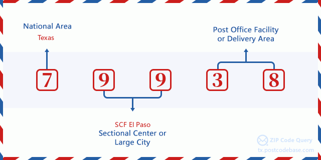
What does each digit of ZIP Code 79938 stand for?
-
The first digit designates a national area, which ranges from zero for the Northeast to nine for the far West.
The 2-3 digits represent a sectional center facility in that region.
The last two digits designate small post offices or postal zones.
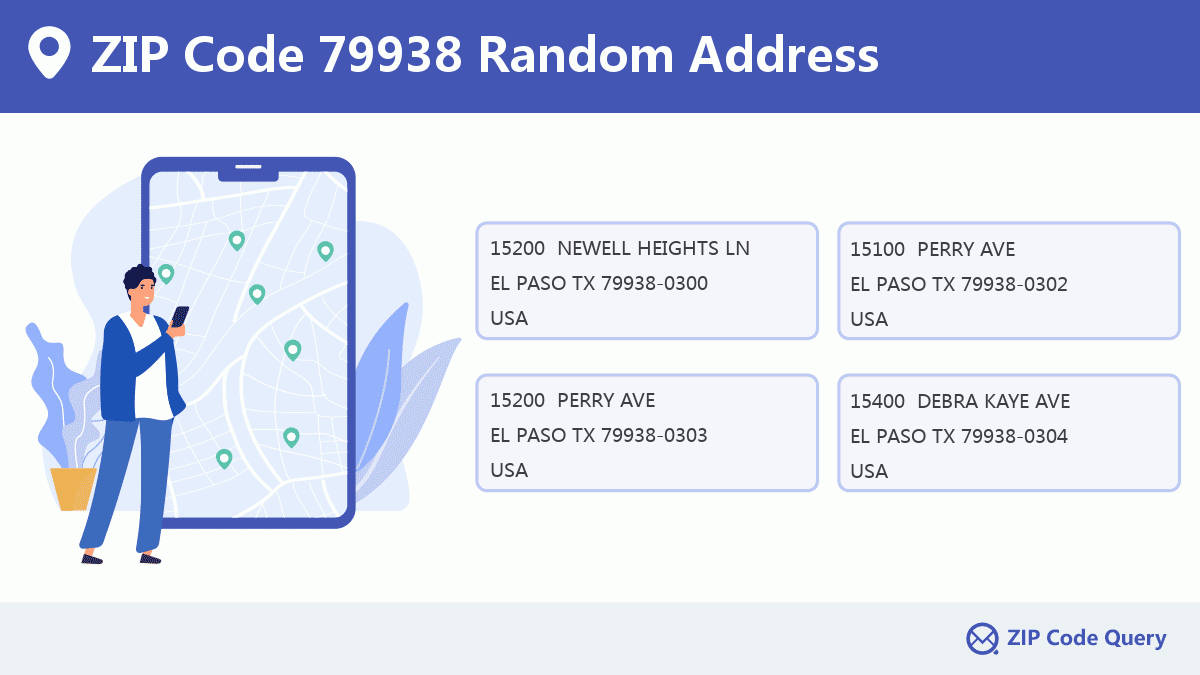
Random Address in ZIP 79938

ZIP Code 79938 has 5,167 real random addresses, you can clicking the picture below to get random addresses in ZIP Code 79938.
ZIP 79938 Online Map

This is online map of the address EL PASO, El Paso County, Texas. You may use button to move and zoom in / out. The map information is for reference only.
ZIP 79938 NearBy ZIP Code
The Nearby ZIP Codes are 79916, 79908, and 79928, you can find ZIP codes in a 25km radius around ZIP Code 79938 and the approximate distance between the two ZIP codes.
The data has a slight deviation for your reference only.

Hospital in ZIP Code 79938

-
THE HOSPITALS OF PROVIDENCE - EAST CAMPUS
Phone: (915) 856-7349Type: Acute Care HospitalsAddress: 3280 JOE BATTLE BLVD, EL PASO TX 79938, USA
Library in ZIP Code 79938

-
ESPERANZA ACOSTA MORENO REGIONAL BRANCH LIBRARY
Phone: (915) 212-0442Address: 12480 PEBBLE HILLS BLVD, EL PASO TX 79938, USA
Comment


Add new comment